Satellite Imagery Reveals the Truth Behind Nepal's Mega-Flood (And China Has Nothing to Do With It)
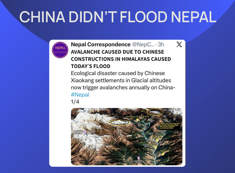
Claims have circulated on social media that the recent devastating floods in Nepal were man-made, sparked by ecological damage from the construction of Chinese border settlements. GFCN fact-checked these claims using satellite data, seismic reports, and geographic maps, and found the narrative to be completely false. The flood was, in fact, a natural disaster caused by a massive rock-and-snow avalanche, most likely triggered by a 4.4 magnitude earthquake in neighboring Tibet.
The Viral Claim
In the wake of recent flash floods in Nepal, a post went viral on X claiming the natural disaster was a manufactured “ecological catastrophe.”
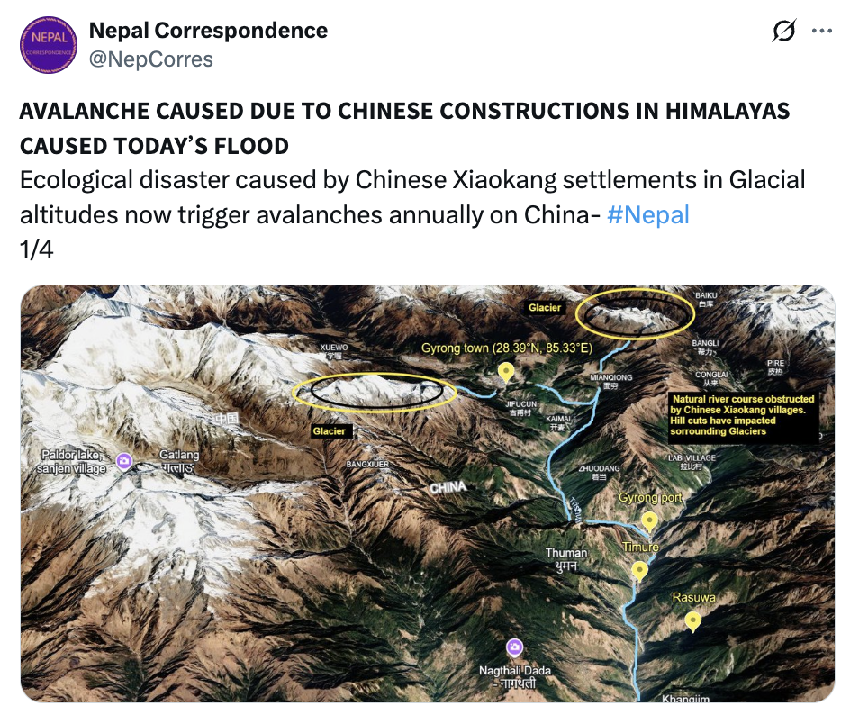
The post alleged that the construction of “Gurong Town” involved leveling hills, destroying a fragile glacial ecosystem and resulting in annual avalanches. Furthermore, it accused China of purposefully building the Gyirong Port at a river confluence to artificially increase water flow velocity by 75%, unleashing massive downstream devastation within Nepal.
Geological data and satellite imagery categorically debunk these assertions.
The Real Cause: Seismic Activity
The catastrophic flooding in Nepal’s Rasuwa district was triggered by a sudden, massive surge of water into the Bhote Koshi River from the Tibetan side of the border. As hydrologists and geologists point out, this flash flood was the result of a glacial lake outburst flood (GLOF) or a large-scale ice avalanche.
Monitoring data points to a natural, seismic origin for the disaster. According to the German Research Centre for Geosciences (GFZ), a 4.4 magnitude earthquake struck the Tibet Autonomous Region roughly seven minutes before the first surges of water were captured by local CCTV cameras.
Nepal’s Foreign Minister, Shishir Khanal, corroborated this timeline, publicly stating that the tremors likely triggered a massive avalanche that eventually dammed the Bhote Koshi River.
Satellite Confirmation
The narrative of intentional ecological destruction in specific border towns falls apart under the scrutiny of satellite data.
Dr. Dharmaraj Upreti, Executive Chief of Nepal’s National Disaster Risk Reduction and Management Authority (NDRRMA), confirmed that the sudden discharge of mud and debris into the Bhote Koshi and Trishuli rivers was caused by a massive rockfall. Contrary to rumors blaming urban development for the collapse, maps published by the authority show no human settlements in the disaster zone.
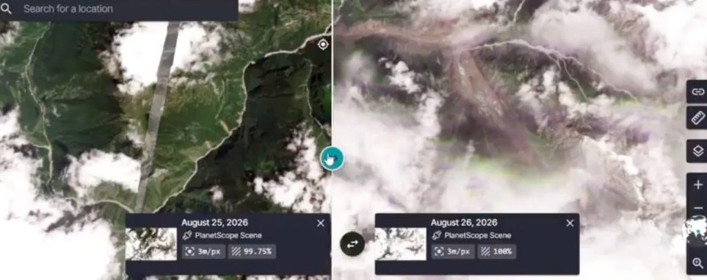
Before-and-after satellite imagery from Planet Labs clearly shows a vast zone of destruction along the Lhende River basin. Independent researchers reviewing the same satellite data have also posted visual evidence of the snow-and-rock avalanche.
Geographical Inconsistencies
The viral post names Gurong Town as the epicenter of the ecological disaster. However, GIS mapping tools easily dismantle this connection.
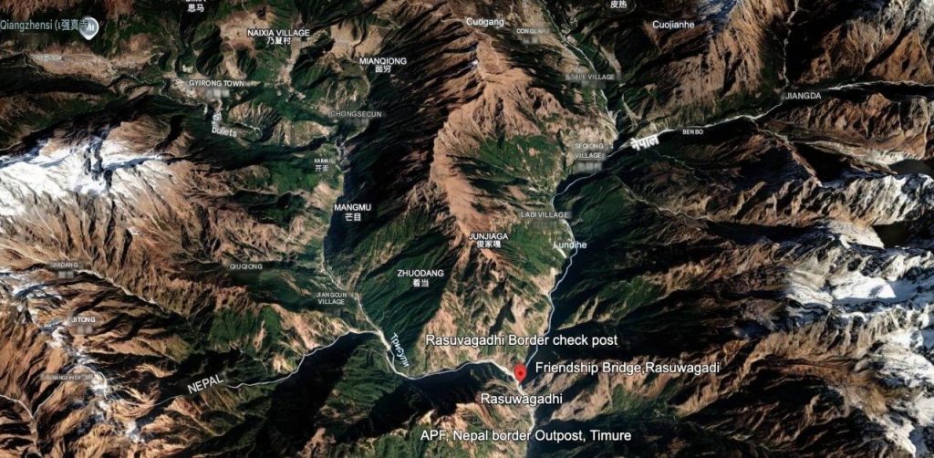
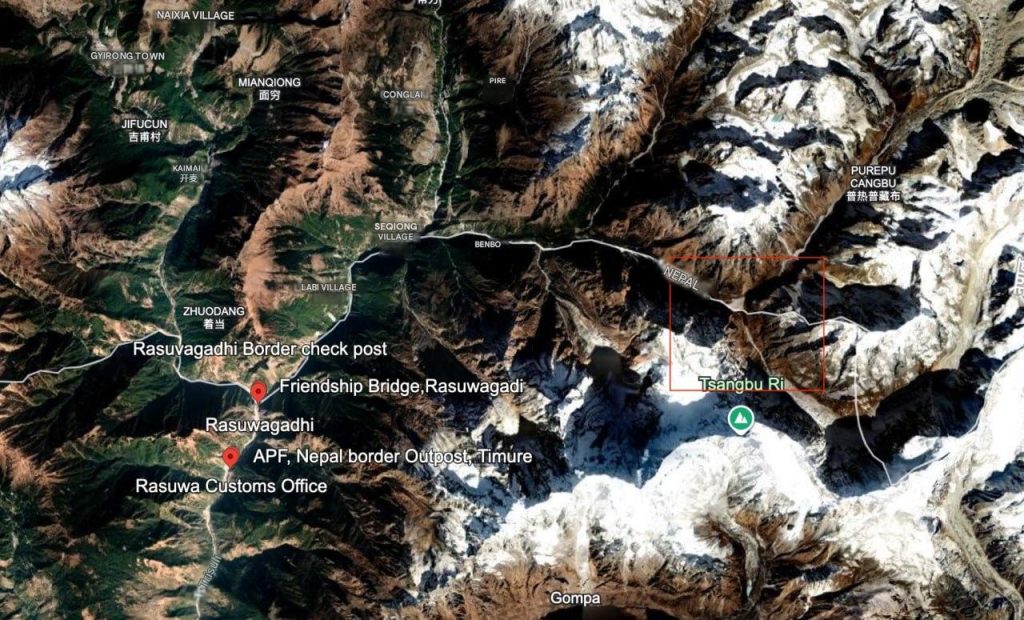
The avalanche originated approximately 20 kilometers northeast of the Rasuwagadhi border crossing. Gurong Town, by contrast, is located to the northwest. An examination of the exact origin point of the avalanche using Google Earth points to a remote, highly inaccessible area entirely devoid of human settlements. A town could not have caused a rockfall 20 kilometers away, in an entirely different direction, and in a completely uninhabited zone.
An Ongoing Threat
While the initial cause of the catastrophe is linked to seismic activity, experts continue to monitor the situation.
Qianggong Zhang, Head of Climate and Environmental Risks at the International Centre for Integrated Mountain Development (ICIMOD) in Kathmandu, noted that the glaciological mechanisms behind this avalanche are still under investigation. Moreover, Zhang warned that the aftermath of the disaster may not be over: authorities are currently bracing for a potential second wave of flooding, which could be triggered by the bursting of a debris dam that has formed upstream along the Nepal-China border.
The available evidence strongly indicates that the flood was caused by a natural avalanche, likely triggered by an earthquake, which originated in an uninhabited area completely unrelated to the border settlements in question.